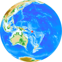
M7.6 Solomon Is. Earthquake of April 12, 2014
Uploaded on April 15, 2014

Event
- Event time: 2014-04-12 20:14:39 UTC (USGS)
- Location: 11.315°S, 162.211°E, depth=29.3km (USGS)
- Magnitude: 7.6 (USGS)
Information in our site
- Solomon Tsunamis on Apr. 12 and 13, 2014 by Dr. Fujii
- Determination of earthquake magnitudes using duration of high-frequency energy radiation and maximum displacement amplitudes: application to the April 12, 2014 Solomon Islands earthquake by Dr. Hara