| Sunda Strait Tsunami on Dec. 22, 2018 |
We have simulated the Sunda Strait tsunami on December 22, 2018 (Fig. 1).
The assumed tsunami source is located in the Krakatau Volcano islands (Fig. 1).
To calculate tsunami propagation, the non-linear shallow-water equations were numerically solved by using a finite-difference method [Satake, 1995].
The used bathymetry data is a 6 arc-second grid data from
BATNAS for the near-field computation.
We show the simulated maximum tsunami height (Fig. 1) and tsunami waveforms at tide gauges of BIG (Fig. 2).
We also show the tsunami propagation in the animation (Fig. 3).
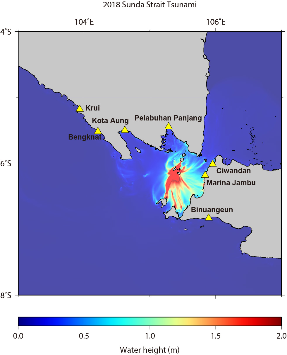
Fig.1 Maximum Height of Simulated Tsunami
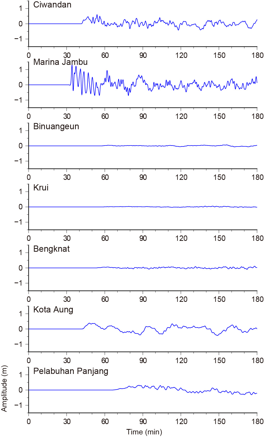
Fig.2 Simulated Tsunami Waveforms at Tide Gauges of BIG
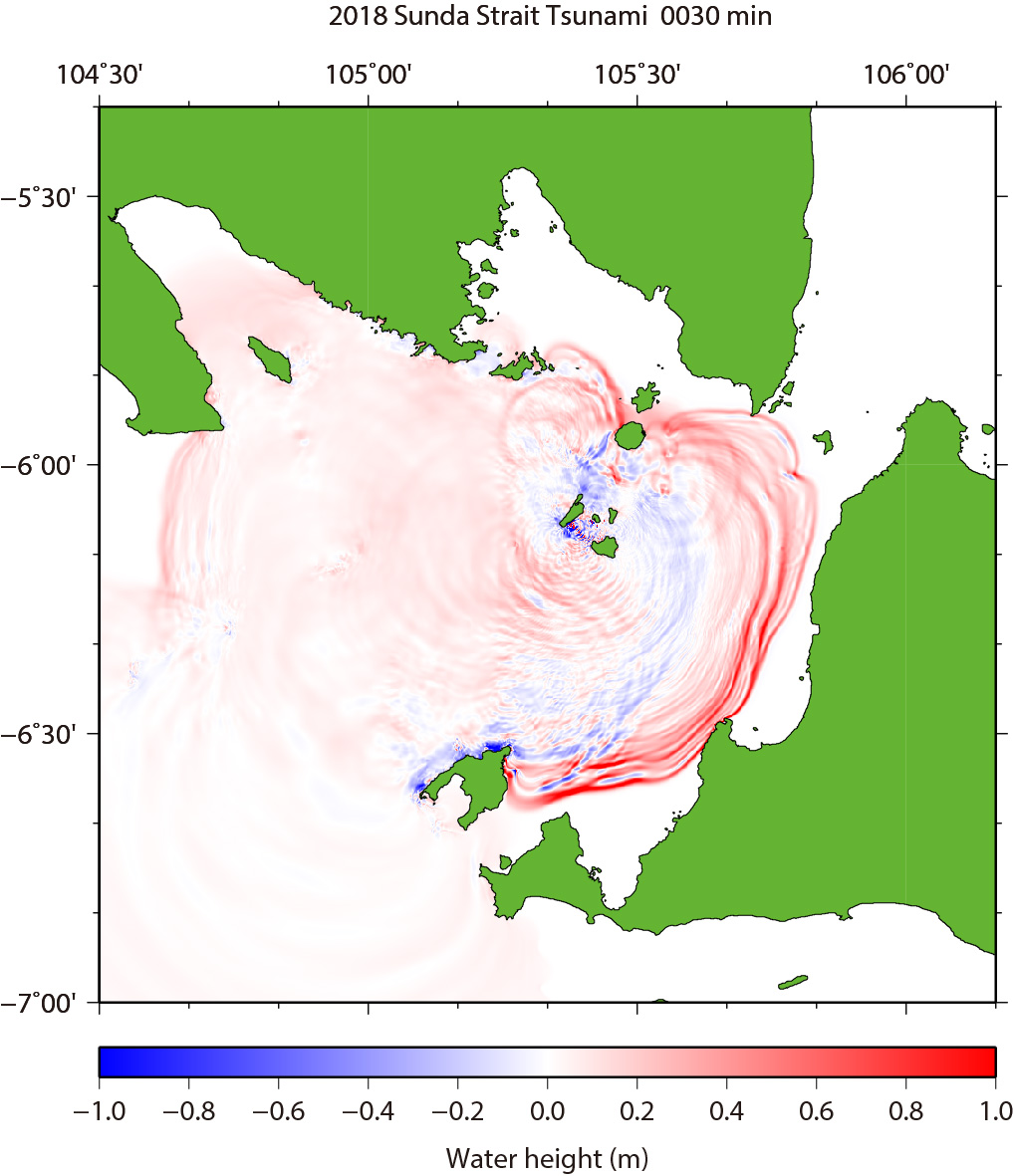
Fig.3 Tsunami Propagation (Click to start animation)
The red color means that the water surface is higher than normal sea level, while the blue means lower.
| by Yushiro Fujii (IISEE, BRI) |
|
|
| References |
|
Satake, K. (1995), Linear and Nonlinear Computations of the 1992 Nicaragua Earthquake Tsunami, Pure and Appl. Geophys., 144, 455-470. |
Last Updated on 2018/12/27