| Kumamoto Earthquake on Jul. 28, 2026 |
We have simulated the tsunami generated from the Akaska earthquake (32.682°N, 130.722°W, depth = 10.0 km, M = 6.8 at 07:27:15 UTC according to
USGS) on Jul. 28, 2026 (Fig. 1).
Fig. 1 shows the assumed tsunami source model from the
GSI's fault model. The fault length and width are 29.14 km x 6.29 km. The focal mechanism is strike: 211.39°, dip: 89.71°, slip: -163.17°. The top depth of the fault is 0.02 km. The average slip on the fault is 1.99 m. The seismic moment is 1.82 x 10¹⁹ Nm (Mw = 6.8) assuming the rigidity of 5 x 10¹⁰ N/m2.
As the initial condition for tsunami, static deformation of the seafloor is calculated for a rectangular fault model [Okada, 1985] using the source models.
The used bathymetry data is the 15 arc-second grid data from
GEBCO_2026, which was resampled to 12 arc-second grid data.
To calculate tsunami propagation, the linear shallow-water, or long-wave, equations were numerically solved by using a finite-difference method [Satake, 1995].
We have downloaded the
Tide gauge data
from the JMA's web site, digitized it
and compared the simulated tsunami waveforms and the observed ones (Fig. 2).
We can see the tsunami propagation in the Yatsushiro Sea (Fig. 3).
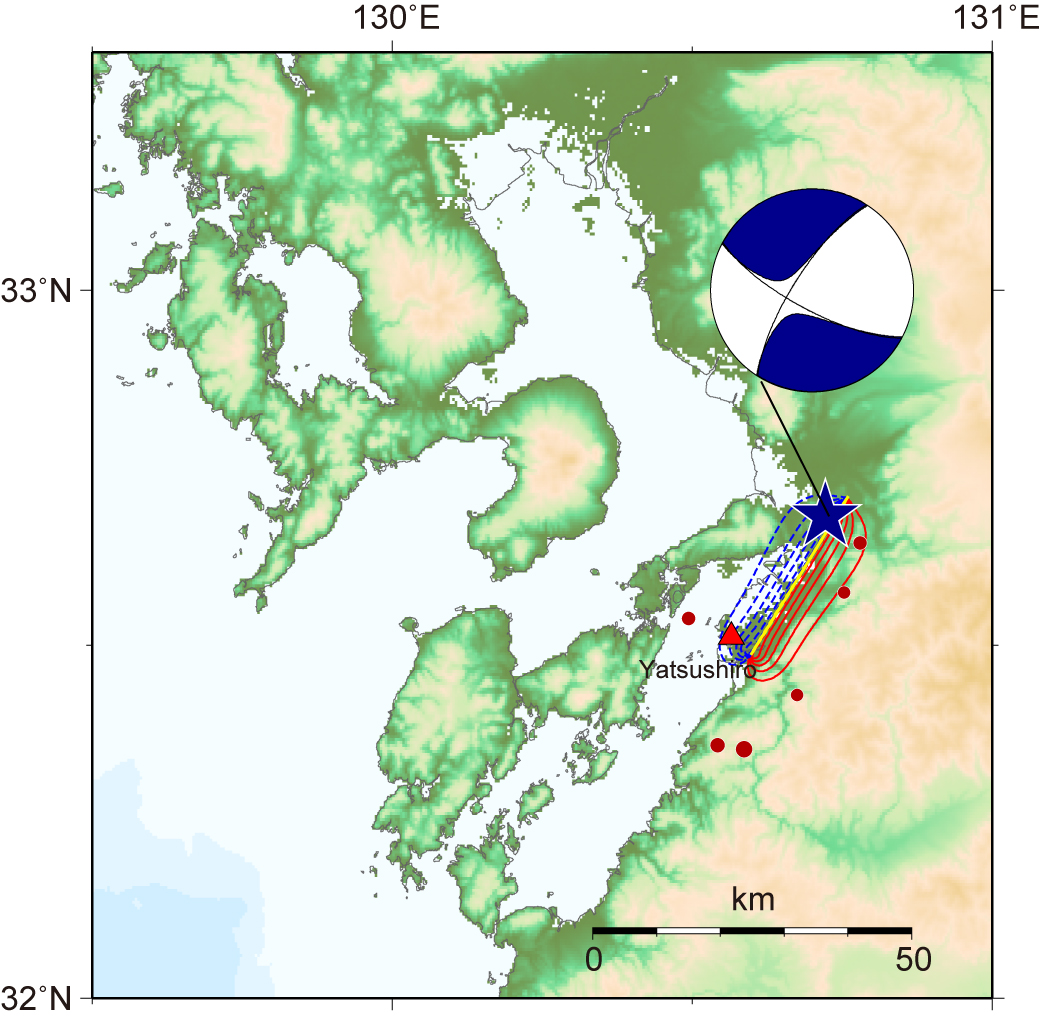
Fig.1 Tsunami Source Model
The red and blue lines indicate uplift and subsidence, respectively, with the contour intervals of 0.05 m. The focal mechanism and aftershocks determined by USGS are also shown.
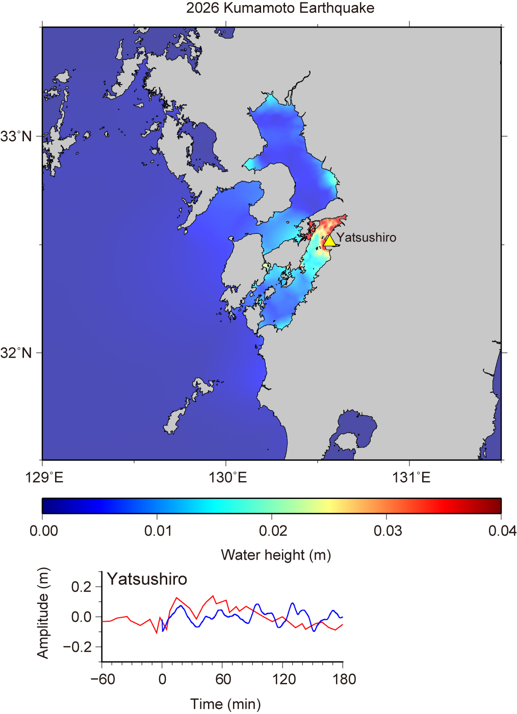
Fig.2 Maximum Height of Simulated Tsunami and Tsunami Waveforms
Solid lines in red indicate the observed tsunami waveforms. The blue lines are calculated tsunami waveforms.
Fig.3 Tsunami Propagation (Click to start animation)
The red color means that the water surface is higher than normal sea level, while the blue means lower.
| by Yushiro Fujii (IISEE, BRI) and Kenji Satake (Univ. of Tokyo / National Central University, Taiwan) |
|
|
| References |
|
Okada, Y. (1985), Surface Deformation Due to Shear and Tensile Faults in a Half-Space, Bull. Seismol. Soc. Am., 75, 1135-1154. Satake, K. (1995), Linear and Nonlinear Computations of the 1992 Nicaragua Earthquake Tsunami, Pure and Appl. Geophys., 144, 455-470. GEBCO Bathymetric Compilation Group 2026 (2026), The GEBCO_2026 Grid - a continuous terrain model for oceans and land at 15 arc-second intervals. doi:10.5285/4f68d5c7-45eb-f999-e063-7086abc036fa |
Last Updated on 2026/7/29