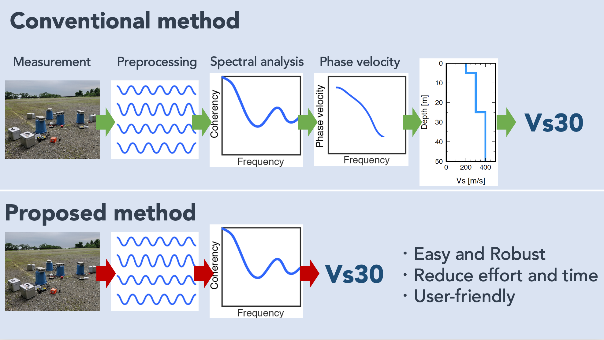
Easy estimation of ground amplification
When an earthquake occurs, the difference in the subsurface sediments is one factor that affects the magnitude of ground shaking. Generally, shaking will be greater on soft ground than hard rock, even in the same earthquake. Examining the amplification of the ground makes it possible to identify areas where the shaking will be more remarkable (more likely to cause damage). Vs30 (the average S-wave velocity between the ground surface and 30 m below ground level) is widely used as a simple indicator of earthquake amplification. One way of the on-site Vs30 estimation is to conduct a microtremor survey. However, it requires the analyst's skill and knowledge to perform the analysis.
We developed a new method to estimate Vs30 quickly with minimal data processing, without the influence of analyst or software. We have also confirmed that the Vs30 estimated by our method is comparable to the accuracy of conventional methods. We expect that the use of this method will help lowering the hurdles to hazard mapping.
Hayashida, T., T. Yokoi, N. Nepal, and M. Olivar (2023)
Direct estimation of Vs30 using spatial autocorrelation and centreless circular array coefficient curves obtained from microtremor array data, Geophysical Journal International
doi:10.1093/gji/ggad006
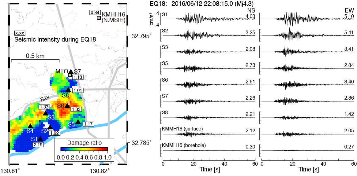
What separated the damage during the 2016 Kumamoto earthquake?
In the 2016 Kumamoto earthquakes, ground shakings of seismic intensity 7 on the Japan Meteological Agency scale (maximum intensity) were observed twice in Mashiki Town, Kumamoto Prefecture. The building damage was concentrated in specific zones of the town. There are various interpretations (differences in the ground, differences in earthquake resistance standards, distance from the fault) to explain the reason for the damage concentration, but the answer is still unclear.
We (represented by Dr. Yamada, Disaster Prevention Research Institute, Kyoto University) visited Mashiki Town two months after the mainshock, and measured 30 aftershocks at eight sites inside and outside the damaged zones. We found a clear difference in peak amplitudes and frequency characteristics of ground shaking between the damaged/undamaged zones. The difference is possibly related to subsurface soil conditions. By analyzing the aftershock records in detail, we also estimated the shallow part of the ground and the deep part (surface to 1500 m depth) of the damaged area.
These aftershock records and subsurface structure data will be valuable information in discussing issues that are still unresolved.
Hayashida, T., Yamada, M., M. Yamada, K. Hada, J. Mori,
Y. Fujino, H. Sakaue, S. Fukatsu, E. Nishihara, T. Ouchi, and A. Fujii (2018)
Subsurface velocity structure and site amplification characteristics in Mashiki Town, Kumamoto Prefecture, Japan, inferred from microtremor and aftershock recordings of the 2016 Kumamoto Earthquakes, Earth Planets and Space
doi:10.1186/s40623-018-0889-2