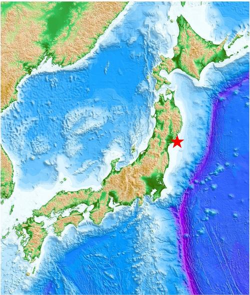
The 2021 Off Miyagi Earthquake of March 20, 2021
Uploaded on March 24, 2021
Updated on March 25, 2021
Information in our site
- Strong Ground Motions (NIED K-NET and KiK-net data) [in English]
- 観測された強震動データ (防災科研K-NET、KiK-net) [in Japanese]
- Prompt report on 2021/03/20 18:09 Off Miyagi Pref. Earthquake [in English]
- 強震観測速報 (2021年3月20日18時09分宮城県沖の地震) [in Japanese]
Direct links
Related institutions
- United States Geological Survey (USGS), USA
- Seismic Monitor, Incorporated Research Institutions for Seismology (IRIS)
The Generic Mapping Tools (GMT, Wessel and Smith, Eos, 79, 579, 1998) was used to make the figure of the epicenter, which is from JMA (https://www.data.jma.go.jp/svd/eqev/data/daily_map/20210320.html). The land topography and ocean bathymetry are from GEBCO Compilation Group (2020, GEBCO 2020 Grid, doi:10.5285/a29c5465-b138-234d-e053-6c86abc040b9).
©2021, International Institute of Seismology and Earthquake Engineering (IISEE)